Sunday, 28 September 2014

South Wales Walking


You have a drastic new hairdo planned for your move to Australia, the consultation has been had, the appointment is made… …and then you get a phone call from your brother, saying that he has to take some annual leave so he’s booked a few days off for you to hang out together in the Great Outdoors… What do you do?

A quick phone call and the appointment is cancelled, and you book your train tickets to Swansea where you will meet your brother. No contest.


The original plan was to involve some rock climbing, but the weather is too damp for that, with rain forecast. I vote for us to head out in my brother’s canoe – a wedding present for him and his wife from their gift list, how cool? – but for some reason this doesn’t happen and we head for the hills instead.

Driving to Brecon Beacons National Park, the particular hill we are aiming for is the highest in South Wales and indeed southern Britain, Pen-y-Fan (pronounced Pen-e-Van – in Welsh, ‘f’ represents an English ‘v’ sound, while ‘ff’ is equivalent to the English ‘f’). At 886m, this is no giant, but it’s still a good walk and is often used by the British Army, including their Special Forces, for fitness and navigation training.

Today the weather is pretty gloomy and misty, but we are following a clearly defined track and my brother walks up here regularly. It is very peaceful, being a work day with less-than-great weather there are few other walkers around. I struggle to keep up conversation with my brother as we walk, and it’s only when we whizz past some other walkers that I realise how fast a pace my brother is setting. This pace must be the reason we’re feeling fine in shorts and t-shirt, while other walkers look more appropriately attired for the weather.

The track, and a walker in Gortex


Following this track, we also pass over Corn Du, the second highest point in the Brecon Beacons. We walk over the saddle between the two high points, with Pen-y-Fan shrouded in mist ahead of us.


Then we are soon at the top of Pen-y-Fan. Pen-y-Fan has a relatively large plateau for a summit, and it is worth looking for the rippled rocks on this plateau. These rocks are fossilised sea bed, from when the highest point in southern Britain was once underwater, and you can see the exact same pattern as you notice at the beach in firm sand when the tide is going out. Amazing.


Atop this plateau is a cairn, supporting a summit plaque. I hadn’t known at the time, but apparently this cairn had been a burial chamber in the Bronze Age. If I had known, I would have a) got a better photo of the cairn, and more importantly b) not posed on it for a photo. Having put the summit plaque on top of the cairn though, this is a natural place for walkers to pose and there was even a queue for the photo-op when we were there. It must get really busy there on a popular day.


We don’t hang around for too long at the top, there are no great vistas to take in thanks to the mist, and besides, my brother has a tip for a real ale pub he wants to find: the Ancient Briton


We reverse our route for a little way before turning off to vary our route back, following a path down the grassy valley side and back towards the road.


Once back at the car, we set off for a late lunch and some real ale sampling. This has been an excellent day, although perhaps not the best preparation for my evening’s plans of going to a bootcamp fitness class with my sister-in-law!


More walking is on the program for the next day, this time heading to the Gower Peninsula and Worm’s Head. This head belongs not to a little wiggly worm, but rather a big fierce Dragon, or ‘Wurm’ in the Viking invaders ancient language.

This is the most westerly tip of the Gower, and is a strip of land at low tide, while it’s a string of small islands when the tide is high. This means that walking here is only safe a couple of hours either side of low tide. At least if you do get cut off from your return, you can wait it out on one of those tiny islands for the next low tide.

We set off from the village of Rhossili, along a well-maintained level path to the old Coastguard lookout. 


Then we simply pick our own route across the uneven rocks of the causeway. 


We walk to the top of the inner head, which is the first higher ground we come to, and is therefore the first island when the tide comes in.


It's a little steep, but not very high and it gives us some great views of the interesting routes we've just taken and that lie just ahead.


We continue on to follow a mixture of dirt tracks and rocky scrambles to get out across the Devil’s Bridge (the rock bridge just visible in the picture above) and to the outer head. You aren't permitted to go right to the end during the sea bird breeding season, but we are there after the season's end so are free to carry on.


This is a great place for wildlife, and we watch the aerial acrobatic antics of a peregrine falcon; watch a swooping cloud of choughs, the UK’s once-rare coastal members of the crow family, that now seem to be making a comeback; and get watched by a cute and curious seal. I do love seals.


Today’s weather is in stark contrast to yesterday, so out at the outer head we stay a while to enjoy the sunshine. We eat our snacks and watch the wildlife, chat about the future, and only reluctantly drag ourselves away from this peaceful place to make the return journey across the rocky causeways. 


Heading back, the view is fantastic and I can't help wishing that I had longer to spend in South Wales, and that I had made more of my time in the years preceding. But Australia beckons, and I leave in less than a week.


Information:


Our route up Pen-y-Fan was pretty much this one: http://www.nationaltrust.org.uk/article-1356405780951/


Sunday, 21 September 2014

A Fascinating Day Out in Pembrokeshire


While doing some voluntary work with the Pembrokeshire National Park I met a very interesting couple who, in addition to their work with the NP, also do work with the local Archaeological Society.

I was chatting to them about their current dig, which sounded fascinating, and so I asked if it was possible to visit as a member of the public. I was delighted when they not only answered “yes”, but also said that all of the archaeologists are very friendly, and that even if the couple I had met weren’t there, then not to be shy about introducing myself and asking questions, as whoever was there would be more than happy to explain everything!

My mum is really interested in archaeology, so I thought that this would be right up her street. I had made sure that I had gotten directions to the most accessible dig (at Craig Rhosyfelin), and that my mum would be able to get to it alright as she has reduced mobility, so as soon as I got in I told her the exciting news. She was as happy about it as I had hoped, and so we planned a day out revolving around visiting this site, plus another famous megalithic site nearby that she has been wanting to visit for ages - Pentre Ifan burial chamber.

So what was quite so fascinating? Well, you may have heard of a little monument in England called Stonehenge? – it’s a little bit famous ;)

Some of my pictures of Stonehenge from a visit a few years ago - not the best quality as I couldn't find the originals so I had to download these from my facebook!


It has been known for some time that some of the bluestones of Stonehenge originate from the Preseli Hills in Pembrokeshire, and this dig that I had found out about was excavating a bluestone quarry site that had been discovered. Not only that, but they had used chemical fingerprinting to confirm the exact bit of rock that one of the bluestones had been cut from!! How incredible!

So we set off into the hills, following the directions I had somehow managed to remember.

Heading into the Preseli Hills


We went through a ford to get there, not something too common any more I think? I used to get really excited about fords when I was small!


Then we arrived at the dig site. I spotted a lady who was near enough to the edge of things that I could chat to her, and said hello. Her name was Kate and she was busy, but very friendly, and she said that if I gave her a few minutes to finish what she was doing, then she would be able to explain the site to us.

I took a few photos, and then when Kate was ready my mum and I went over to her and she gave us a fascinating insight into the site. I wrote down everything I could as soon as I got home, as I didn’t want to forget anything! So, here is a tour of the site in pictures :)


The rock outcrop above is a confirmed Bluestone quarry site. One stone is definitely from here, and it is likely that one or two others are from here too.

Archaeologist Kate giving us a guided tour of the site


Above is an abandoned monolith that was uncovered by the excavations. It is still resting on stone rails that were prepared for the removal of the rock, but at some point during the manoeuvre it cracked and so was left in situ.


In these pictures you can sort of see the stone rails that the monolith is resting on. This was all totally buried beforehand, and was identified by geophysical techniques before being uncovered.


Next to the bluestone quarry and in front of the megalith, these white tags mark the soil layers of the half of a significant find which has been 'left in section'. This means that where the archaeologists have found something significant, they have not dug the whole thing out, but have left a cross section intact so that the structure of the layers can be seen. 

This find was a fire pit, which had been dug and dressed with stones of quartz. This pattern of using it as a fire pit and then dressing it with quartz had been repeated on multiple occasions. Carbon dating of the layers showed that the pit had been used on different occasions over a period of 500 years. The pit itself dated back 10,000 years - so much older than Stonehenge, which is about 4000-5000 years old, and indicates that this site was perhaps significant long before bluestones were quarried from there! I wonder if there was something intrinsic in the area that appealed to those who saw it all those thousands of years ago, or if it was a cultural significance that was passed on down generations - 5000 years of passing-on does seem like a long time though...


Above is a view of the site from the other direction: the rock strewn area contains patches of soil that had been packed down with crushed stone/gravelly bits, possibly as a firm working area for moving the stones. There are also scrape marks on various rocks, showing where the large stones had been shifted over them. 

Towards the far edge (from this angle) of the excavation, this type of ground just drops off and is replaced by fine alluvial silt, indicating that from this point on towards the now-small stream (the other side of the hedge in the background - where the ford was) was all underwater at that time. Beavers would have lived in Britain back then, so their damming activity could well have contributed to flooding localised areas. Fascinating to think of how different everything would have looked back then!


This little part of the quarry area has been positively identified, by chemical fingerprinting, as the exact site from which one of the Stonehenge bluestones was taken. The gap left behind lies behind the first upright finger of rock.


Kate guiding a student - they had found a potential post hole site, so now the student had to begin trowelling instead of brushing the soil away, so as not to blur the demarkation of the find. That area of more browny-orangey soil where they are working did not have the stone/gravel pressed into it, and in this patch they hope to find evidence of living quarters or similar for the stone workers. Back at that time, people put a huge amount of effort into building stone burial chambers for the dead, however they didn't go to the same lengths for their living homes, so evidence of these is relatively scarce.


After this fascinating tour of the dig site we watched a while as archaeologists dug, brushed, measured and recorded, until we decided it was time to head off to Pentre Ifan - a stone burial chamber - which was a short drive away from the dig site. 

We parked up and walked the short path from the road, and once there we had our picnic. My mum was really happy to have been able to go there - as she struggles a bit with mobility she doesn't often get out to places like this, and we were having a lovely and interesting day out.

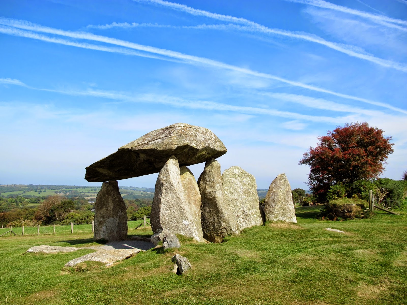
Pentre Ifan has been labelled the most impressive megalithic site in Wales, and it dates from a similar time to Stonehenge. You can read more about it here (or of course do an internet search of your choice!) but I'll leave you with the pictures I took:


Thank you for joining me for a bit of my local history. I do find it so interesting, and I hope you enjoy it too :)


Saturday, 20 September 2014

Coast Path Working


I love Pembrokeshire, my home county, immensely. I also love working outdoors (when the weather is nice) in conservation, and so while home for the month of September, before emigrating to Australia, I took part in some voluntary work with the Pembrokeshire Coast National Park Ranger.

It was great fun, and as usual (based on my experience with volunteer work like this) there was a lovely group of lovely and interesting people to meet.

Our work on this occasion was some maintenance on the Coast Path. I have talked before about the Coast Path and how much I love it, so it felt great to be ‘giving something back’.

The work was required on a small section of path near to the village of St Ishmaels. In the storms experienced by the UK last winter, lots of the coastline around the whole country took quite a battering, and the natural erosion that is constantly occurring was greatly accelerated in some areas. Many sections of the Pembrokeshire Coast Path were affected by soil erosion and cliff falls, with some sections of the Path being left too close to the edge and on unstable land, and other sections even falling away completely.

The National Park Authority has worked hard to fix and renew where possible, and to re-route the Path where this was necessary. We were working at a spot where the path had been re-routed to avoid an area of path that had been lost to cliff falls: the path had been routed through a hedge bank, which had had a gap cut through it for the Path to run. Our job was to restore the cut ends of the hedge bank, using traditional techniques to protect the bank against erosion and to make the work tie in with the original look of the bank.

The new gap in the bank for the re-routed Coast Path


Hedge banks are a pretty old technique for bordering farmland, and also provide an important habitat for lots of wildlife. They are comprised of a bank of soil built up along the boundary, which is then faced with stonework on either side, while the top is left clear for planting. The stonework protect the sides of the bank and maintain its form as a bank, while the roots of the plants grow to bind the whole structure together. It’s clearly a technique that works well, as many hedge banks in the UK are hundreds of years old.

We weren’t building a bank from scratch, so we didn’t have to do much soil work, but we did have to finish off a few courses of stone work in various places (the work had been begun on a previous occasion), then backfill any gaps with soil, before laying turf taken from the sides of the path on any bare areas on top.

First we gathered up some stones, they had been removed from fields by local farmers while ploughing, and the farmers had then offered them to the National Park for the restorations. The Ranger had a nifty little tracked hand-truck for transporting the stones along the path to where they were needed.

Loaded up and ready to go!


We had a wonderful view while we walked along.


When we got to our work spot, you could see the great work that had already been done by the volunteers.

Unloading the stones

The stonework so far


We worked away, trying to find stones that fit in well so that the stone facing would be stable. It was quite time-consuming to get the stones to fit, but very rewarding. We were passed by lots of walkers as we worked, and they were all friendly and said wonderful things about the work done to maintain the Coast Path. Some even asked to take photos of us working! (I must say, I did feel a bit of a fraud, as I had been working there less than an hour when the photos were taken!)

More stone work complete

Stonework finished, and back-filled with soil

Once all the stonework was finished, we used mattocks to dig up sections of turf from the sides of the path with which to top off the hedge bank. Once the plants take root, they will bind the new work and keep it strong. Over time, plants will take roots in all of the gaps, and eventually you won’t even see the stones at all.

Finished! With the turf on top - I hope it takes root!


Just a few hours’ work between us, but great results I think :)


Thursday, 18 September 2014

Ironman Wales 2014


This is not me being adventurous in any way, but it was so impressive I decided to post it anyway. 

Sunday 14th September 2014 saw the Ironman Wales event take place in Pembrokeshire.  


Starting and finishing in Tenby, the participants begin with a 2.4-mile (3.86 km) swim in the sea off Tenby. Having got out of the water they then have to run up the hill into Tenby town to transition to their road bikes, ready for a 112-mile (180.25 km) bicycle ride through the beautiful Pembrokeshire countryside. As if all that isn’t enough, on completing the bike course they then have to swap their bike shoes for running shoes, and complete a marathon! 26.2-miles (42.2 km) of running after all that!

These are obviously epic distances, but the Ironman has a strict time limit of a total of 17 hours to complete the race. The race starts at 7:00 am, and cut off for the swim is 9:20 a.m. (2 hours 20 minutes), the bike cut off time is 5:30 p.m. (8 hours 10 minutes), and the mandatory marathon cut off is midnight (6 hours 30 minutes). Any participant who manages to complete the triathlon within these timings becomes an Ironman, although I think that anyone who can keep going for 17 hours deserves some recognition, even if they don’t finish the entire course!

The day began for us with me walking over to my friend’s house, and then she drove us to Tenby. We were hoping to see some of the swimming, but by the time we had caught the park and ride service that was running for the supporters, and made our way through the crowds, we realised that it would take a while to make our way to the area where we would be able to see the swim. Unfortunately we didn’t manage this, but soon after our arrival the first swim finisher came running towards transition. We found that we had a good spot to watch the swimmers run in towards the transition point, where they would transform into cyclists, and whizz back past us in the other direction.

Some of the cyclists are still getting things ready this soon out of transition

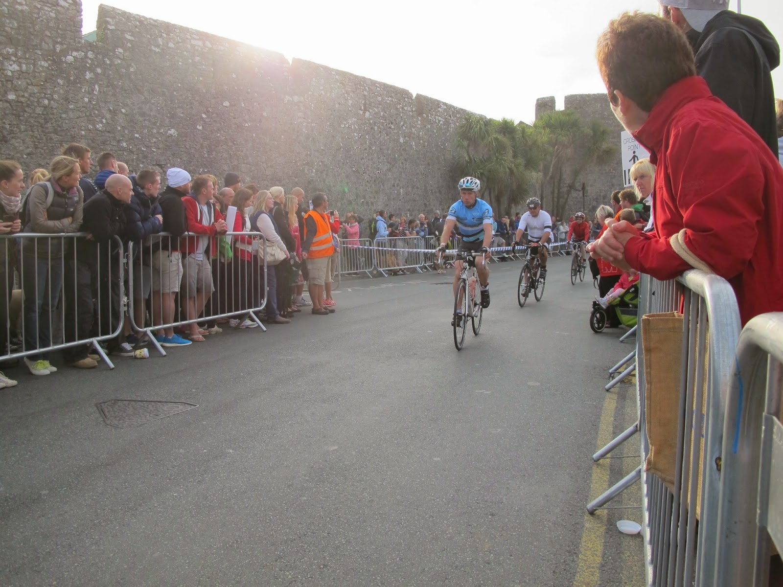
Running in and cycling out, past the town walls of Tenby

We stayed in that place until the very last competitor had gone through. Sadly many people didn’t finish the swim – some had never swum in the sea before, and simply weren’t prepared for the challenge. Others sadly succumbed to seasickness due to the choppy conditions – this seemed really awful, as all the preparation they must have done simply ended in an unavoidable early finish.

Even this early-on however, we got to see some really nice examples of the sportsmanship of the athletes taking part: there was an accident with a cyclist falling off. I couldn’t see it happen, but from people who had a better view I think this was because a couple of bikes were close together, but they had to brake to avoid spectators who were crossing the road. These crossing points were controlled by marshals, but at this point there was some lack of thought going into it, and they were letting too many people cross at once – meaning that the pedestrians couldn’t squeeze through the gap in the barriers quickly enough to be out of the way when more cyclists came – there were lots of ‘boos’ from the crowd at this. Anyway, the outcome was that one cyclist came off his bike. He had to fiddle with the bike quite a bit to get things running smoothly again – a finely tuned road racing bike can be delicate to falls. While he was struggling with this, another cyclist came round the bend and saw him, and stopped to help! The roars of the crowd when these two got on their way again were huge. Lots of support for those two!


Another guy had his wife and tiny son (about 2 years old maybe?) waiting opposite me to cheer him on. As he came into sight the wife pointed out to the little boy “Look! There’s daddy!” The dad spotted them too, and pulled over to give them a cuddle and get a photo taken! Very cute!! Afterwards the little boy was so excited, and kept calling out “We saw daddy! We saw daddy!” A bit of a melty-heart moment!


Most importantly for us though, was spotting our friend Chris as he went past. I’ve known Chris since I was about 12, when I joined Scouts. His dad Harry was the Scout Leader, and it was a really great group. Sadly, Harry died from cancer last year, and Chris decided to take part in the Ironman to raise money for Macmillan Cancer Support. This is also a charity close to my own heart, as their help and support was invaluable when my own dad was dying from cancer back in 1999. Even more impressive is that just last week Chris was in an accident while training on his bike, getting knocked off by a tractor! His JustGiving page is here if Macmillan is a charity you like to support.

Chris (in the blue top) beginning the cycle ride


Once all of the cyclists had gone past, we made our way back to the park and ride bus service, to get the car and move on somewhere to watch the cyclists. 

Tenby Loves Ironman (and -woman!)


We went a short way to the village of Carew, where we were able to sit on the wall of a small bridge and cheer on the riders. This section was a 2-lap section, and on the first time around many of the riders were in great spirits – lots of smiles, shouts of thanks for the support, and even some funny comments as they whizzed by! 

Cyclists at Carew


We spotted Chris here on both of his laps, but I wasn’t quick enough with the camera to get a good shot of him unfortunately. The only picture I did get was this one of him as he headed up the next hill. He’s the bottom rider in a blue shirt in this picture, but he proved a strong climber and was overtaking other riders up the hill until he was no longer in sight.


By 2pm we were getting pretty hungry, so we headed back to Tenby again to get some late lunch. Already there were Ironman athletes beginning the marathon, so we followed the course up through town, cheering them on as we went, until we got to a lunch spot. Refuelled, we spent the rest of the afternoon moving from spot to spot to cheer on the runners. The marathon was a 4 lap affair, so as more cyclists finished and got their trainers on for the run, the course got busier and there were more people to cheer on. 


The athletes were given coloured bands to wear, a different colour at each lap, so you could see how far along they were. The lead male and female athletes were also accompanied by a cyclist displaying a sign telling you they were in the lead - plus the motorcycle film crews. Here is the lead male running past:


We were pleased to see this guy too - we had spotted him going to the transition on his sticks, and were amazed to spot him a few times on the marathon circuit:


He was richard Webster, an ex-Wales and British Lions rugby star. He was using the crutches to take the weight off his legs after a long rugby career requiring multiple knee operations.

After a while we found ourselves on a small side street. A lady opposite was cheering people on by name, and we realised that the athletes’ numbers, which they now had to wear on a band around their waists, had their names written in small letters beneath the race numbers. So when this lady moved on – having spotted the athlete she was looking out for - we began cheering their names as they passed. We are both very quiet normally, and we really surprised ourselves with how enthusiastically we were shouting! We soon really got into it, spurred on by the gratitude some of the athletes showed at just having a little extra support.

Our cheering spot


So enthusiastic were we, that soon the whole street-full of supporters was shouting on the athletes by name! We saw Chris go past this spot twice, although we only just spotted him the first time as he was no longer in blue, having changed into his Macmillan top for the run!

A bit of a smile this time, and a thumbs up!


We had to move on after a while, as my friend’s little boy needed the toilet. The street near the public loos was pretty quiet, so while we were there we took up our cheering tactics again, and soon had more people cheering on the athletes again. 

Another inspiring athlete, carrying on despite injury. I hope he made it!


Our next spot was on an uphill section. The pain on the faces of the runners was so evident, and we shouted even harder to encourage them up the hill. By this point our hands were red and swollen from clapping, our voices were very hoarse, and it was getting dark. We stayed as long as we could, but it was a Sunday and my friend’s son needed to get to bed, ready for school in the morning.

We both felt guilty that we couldn’t stay to support everyone right through – we had been there for over 12 hours, and would have gladly stayed until midnight I think, as we had so thoroughly gotten into the spirit of it! We had even been filmed a few times by the cameramen capturing the event, as they were so impressed with our cheering!

I hope all the athletes who took part are having some well-earned rest today!