Friday, 25 April 2014

Gentle Walking in The Chilterns

The Ashridge Estate and Ivinghoe Beacon


I have a big trekking trip booked for this summer, therefore it’s really important that I get out walking as much as possible. As I’m recovering from a hip injury caused by overtraining, and now also recovering from whiplash after my car was crashed into, I have to be sensible when it comes to my return to exercise.

Taking things too easy is very frustrating for me – don’t get me wrong, I love to take it easy sometimes. But othertimes I want to be able to just get out there and get the adrenaline flowing!

Fortunately, I currently live near to the Chilterns Area of Outstanding Natural Beauty (AONB), the North Wessex Downs AONB and the Dunstable Downs (part of the Chilterns). This is an area of rolling chalk downland with lots of wildlife and beautiful views and a great many footpaths, making it a great area to use for my return to long-distance walking. The last couple of weekends we have therefore headed out on easy longish walks so I can begin to build up my walking fitness.

Yesterday we began our walk in the picturesque village of Aldbury. This looked like a ‘proper’ southern English village; it had an old fashioned red phone box and post box, beautiful cottages, a pretty and well-kept church and a lovely duck pond in the centre.


From our start point we walked up the hill through woods to the Ashridge Estate, a large estate of woodland, parkland and downland run by the National Trust. 

Spotting pheasants on the way.


Near the visitor area there we saw a chainsaw sculpting display taking place, and stopped to watch for a little while.

Richard Balaam ~ Mr B's Chainsaw Carving


Then we carried on, walking all the way through the woods. The trees were mostly bare and the beautiful woodland flowers were little pops of colour amongst the brown and green of the woodland floor.

Gorse

Wood Sorrel


We continued walking until we left the woods behind and were out in open downland. The ground was gentle rolling hills with fields of rape noticeable as their yellow flowers coloured the landscape. Ivinghoe Beacon is a prominent hill in this area, although the countryside is so gentle that its elevation is just a mere 233m. Its prominence means that it was a beacon site in ancient times, from where a signal could be shown for great distances to give warnings in times of crisis.


From the Beacon you can easily see across to the Whipsnade White Lion, cut out of the turf to display the white chalk below, in the same way as the more famous chalk carvings such as the Cerne Abbas Giant or the Long Man of Wilmington, although the Lion is obviously much more recent. Created in 1933 for the Whipsnade Zoo, apparently during World War 2 it was all covered up so that it wouldn't provide a landmark for air raids.


The open rolling landscape also creates ideal conditions for model aeroplane enthusiasts. Someone was flying their model glider as we walked past, then from the other side we also saw a real glider being towed up by a light aircraft.

Model...

...and real!


Dropping down again from the Beacon, we walked back through the fields of rape and up the hill again back towards the Ashridge Estate visitor centre. 


On the way we saw three red kites, two of them attacking the other. I have never seen this behaviour before, although I see red kites almost every day where I live. I have posted a question to see if I can find out more.

Edit to add: The RSPB, who I asked about this, came back to me with this answer: "Apparently the fact it was three red kites makes it likely to be an established pair seeing off an interloper. In the winter, red kites are social and at that time of year they are tolerant of each other. In the spring and summer they become less tolerant, especially of lone birds they don't know. Neighbouring birds who are familiar (red kites nest about a kilometer apart) would not be attacked. But a strongly-bonded pair (red kites will stay with the same mate year after year) would see off a single strange bird. If it is a female, the female in the pair would lead the attack, and if the strange bird is a male, the male in the pair will take the lead." This fits in with what I saw, as if they were fighting for a mate then you would expect to see 2 birds chasing the third while fighting with each other, but it was definitely 2 birds working together to fight the third, so I reckon that's the mystery solved!

You can see gaps in the feathers of the poor victim!


Returning to the main visitor area, we saw that the Bridgewater Monument was now open to visitors. According to Wikipedia, the Bridgewater Monument was “built in 1832 in memory of Francis Egerton, 3rd Duke of Bridgewater (1736–1803), ‘the father of inland navigation’. It is 108 feet (33 m) tall, with 172 steps inside, designed by Sir Jeffry Wyattville in a Doric style. It overlooks the village of Aldbury and the Grand Union Canal. It was built away from Ashridge House as his mother wanted "not to see or be reminded of my infernal son".”

The Bridgewater Monument


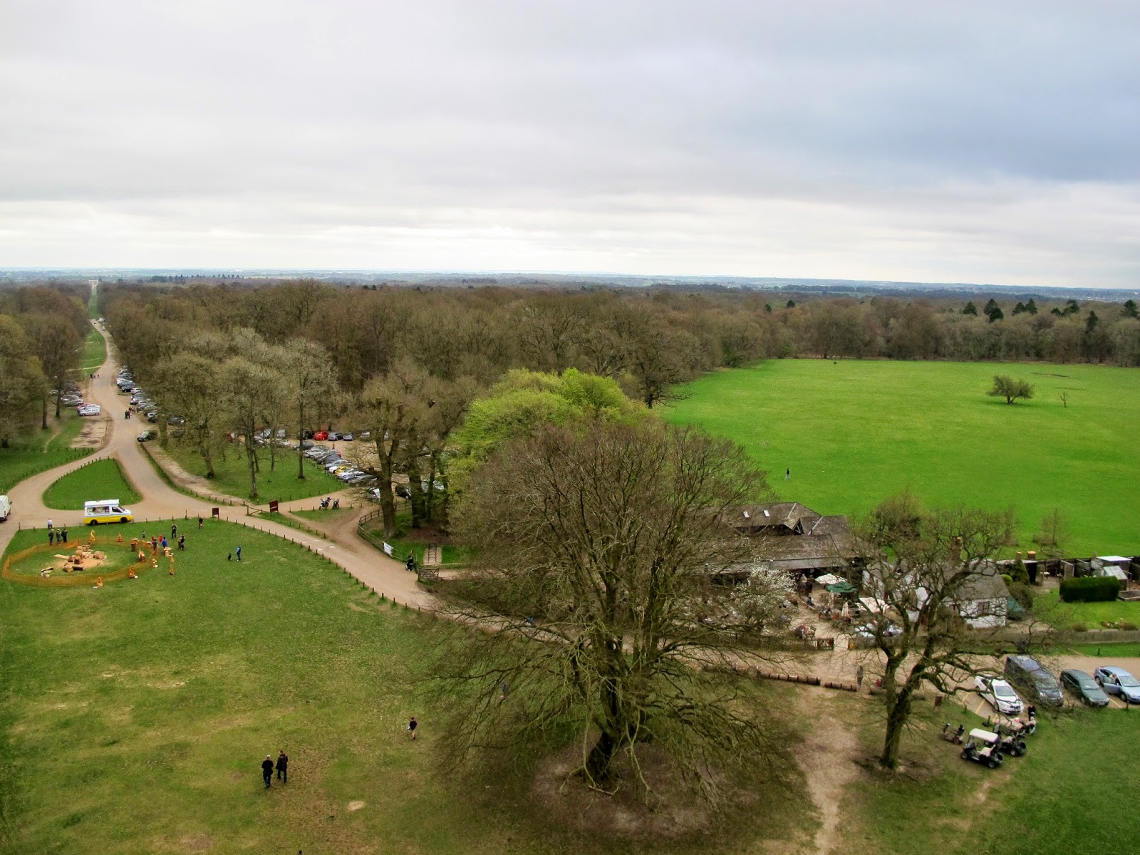
Our National Trust membership cards had arrived the previous day, so we showed these to get free entry to the Monument and took in the views from the top. 


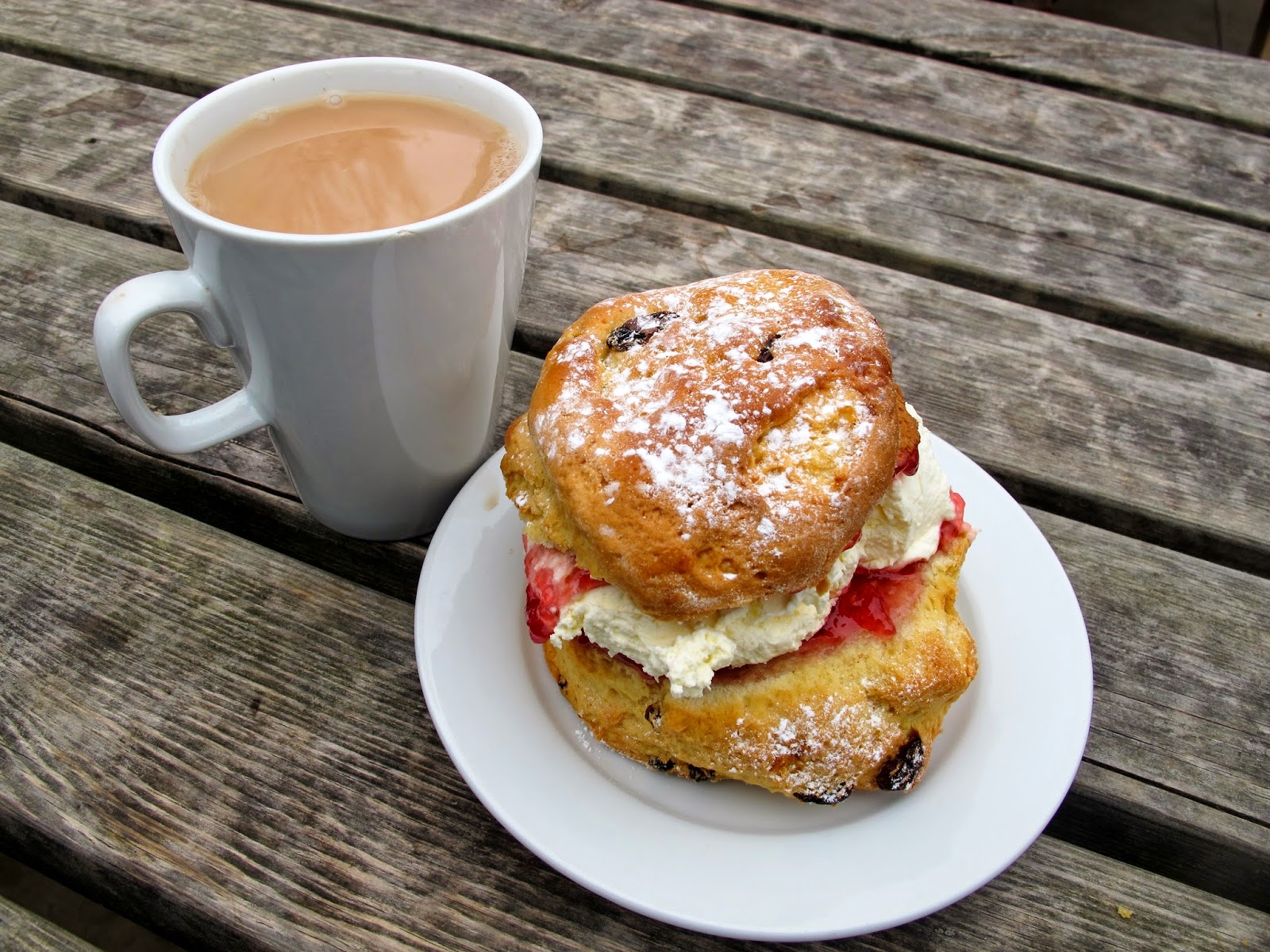
Satisfied, we came back down again and headed to the visitor centre restaurant. After all, if the opportunity is there then it would be silly not to finish a country walk without a cream tea!


Thursday, 17 April 2014

Inca Jungle Trek, Peru ~ Day 4


Foreword: from November 2013 - February 2014, I went on a backpacking trip in South America, visiting Peru, Ecuador and Bolivia. 


The 4th day began at 4am. Not generally the sort of time I really like my days to begin, but when Machu Picchu is the goal then I guess you have to make some exceptions!

I made my way through the rain and dark and the small town of Aguas Calientes to meet up with everyone else. The accommodation where we had been due to stay for night had not had enough space for all of us, so along with some others I’d had to stay somewhere a little further away.

I met with Grace, and as not everyone was ready we decided to set off by ourselves. We were able to leave our baggage at the hostel and carry just the drinks, snacks and waterproofs that we would need for the day. Walking without my heavy-ish bag felt like a wonderful relief, although perhaps not enough so to make up for the earliness of the start!

We retraced our steps along the route of the river, back towards the railway line we had followed the previous day. We arrived at the bridge over the river in time to be not too far back in the queue, and waited our turn to get through the check point. Showing passports and permits, we were let through and we started to follow the path.

The path was obviously very clearly marked and very easy to find. Unfortunately it was also very steep! As the road for the bus snakes its way up the mountainside making switchback after switchback, the footpath cuts right though heading straight up in a series of stone steps. The steps lead up through cloud forest, and every time you reach a section of road you emerge into the open in order to cross the road. As the morning gradually lightened, these breaks in the trees began to afford mist-veiled views of the surrounding area. 

'Happy Mountain', with the river running around it.


Grace led the way up, and I stayed hot on her heals for several sections of path. We steamed past other walkers, legs pumping like pistons to carry us onwards and upwards. Then all of a sudden my body decided it couldn’t keep the pace any more, and no matter how hard I tried I could no longer keep with Grace. My legs didn’t hurt too much, but they just wouldn’t respond to my demands to go faster, and after a little while longer my breathing couldn’t handle the thin atmosphere either and I had to take a break.

It was so frustrating to watch people who we had cruised past earlier, now cruise past me. I’m used to being reasonably fit, and I found it really difficult to face up to how unfit I was right then. My rest stops had to get more and more frequent, and I got more and more frustrated. There were other people on the track going at my pace though, and we would end up leapfrogging each other – I would pass them as they rested at one road crossing, then they would pass me on the next. I got talking to a few people who I kept encountering, and the banter cheered me up.

The steps up just seemed never ending, and I began to wonder if I would have any energy left at the top for looking around Machu Picchu! Finally though I made it to the entrance. Despite being the last of our small group to arrive, there were few other people around and we got through the entrance checkpoint quickly.

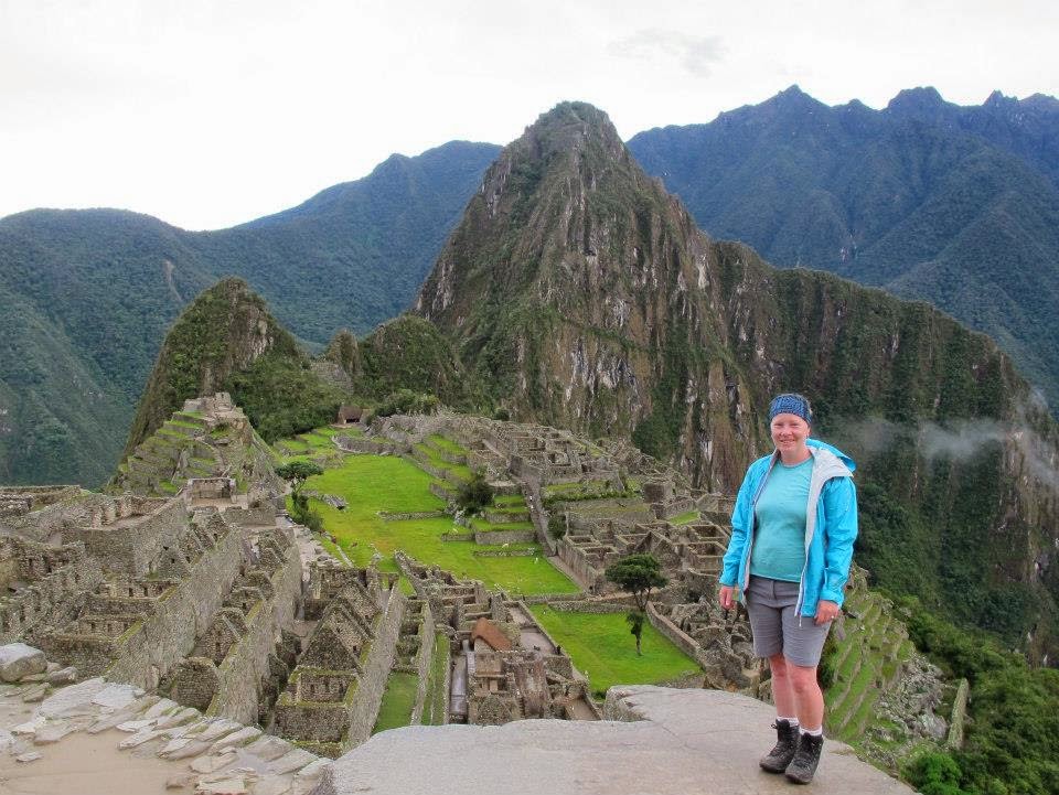
There was yet more walking to be done from here to get to the site, along a path and then up more steps. Then all of a sudden there it was, on our right hand side, shrouded in mists but still one of the most famous and instantly recognisable views there is:


Clouds of mist came and went all around us, and the sun rise was a mere gradual lightening of the sky thanks to the thick veil over the sun, though we were assured that it is spectacular during the dry season. 

The sun rising above the Incan Sun Gate


The Urubamba river, where we began our ascent earlier, was a brown ribbon far far below us, testament to how far we had come that morning.


When the mists allowed, you could see snowcapped mountains from the ranges around us.


We stood in awe for a while, trying to soak it all in. Still relatively few people were there and we were able to contemplate this magnificent site in peace. Our reward was that the mists cleared briefly, allowing us to get some better photos.


It was mind-blowing to think of people building this almost 600 years ago, without machinery as we know it, and without the use of the wheel. it has undergone substantial restoration, but the reason it was so much better preserved than other areas is equally amazing - the Incan people, knowing that the Spanish were on their way, went to work destroying the paths that led here and destroying path junctions so that as many paths as possible would not be found. So successful was this plan that the Conquistadors never found Machu Picchu, and it wasn't discovered by outsiders until American historian Hiram Bingham came across it and brought it to World attention in 1911.


We did have a long tour of the site, with a few things pointed out, but I confess I was so tired and there was so much to take in that I can't remember too much. However, you can read all about Machu Picchu in lots of places, for example here

After many hours of exploring the site, we were so tired that we felt it was time to leave. We had met up with my husband after he had arrived from the 'real' Inca Trail, and the three of us headed off. I was delighted to find that the bus was running again afterall, although we had to get out to walk around the areas of landslides, and then re-embark on a new bus!


Back at Aguas Calientes, the final thing to do was to shop at the handicraft market while we waited for our train back to Quito. What an amazing day :)


Wednesday, 16 April 2014

Inca Jungle Trek, Peru ~ Day 3


Foreword: from November 2013 - February 2014, I went on a backpacking trip in South America, visiting Peru, Ecuador and Bolivia. 


Of course all good things must come to an end, and it was time to get out of the wonderful hot springs, get dressed back into our cold wet clothes, and get to our accommodation for the night and dinner. The accommodation was very basic – one bathroom between about 20-something people, and my room was crammed full with 7 beds and barely enough room to walk between them.

Santa Teresa, our town for this night, while small still had a lot more going on than had Santa Helena. There were bars and discos to enjoy after dinner, but most of us were too tired to contemplate this and so we chatted with each other when we got back to our hostel before going to bed. Some people did go out however, and I don’t think they enjoyed the next early start one bit!

At dinner we had been given a presentation by a representative from a zipline activity centre. So for Day 3 of the trek we had the option to trek for a full day, or to go ziplining – including a 1km zipline, claimed to be the longest in the world – then just trek for a couple of hours in the afternoon.

Grace and me all geared-up at the start


Although an extra expense, it wasn’t too much (equivalent to £20 or US$30) and so I opted for this easier option. There was some steep uphill walking involved in getting to the high point to start ziplining, but not hours of it by any means. 

We whizzed down several ziplines, and although they involved being suspended by a single cable above the ground far below, they seemed much more enjoyable than the plywood crate of the previous day! I can sometimes be pretty scared of heights – earlier in the trip I’d got really anxious just climbing up the tower of a church in Quito – but on this occasion I was feeling pretty brave and took it all in my stride. 

The first zipline - about 400m long


One of the ziplines was said to be the longest in South America, and I've even seen some claims that it's the longest in the World! At 1000m (1km) long, you can barely even see the person on it as they near the end. You need to tuck-in as you zip along to keep enough speed to make it to the end. I managed to zip all the way to the end of the line, but several people - either because they were enjoying the ride and taking photos, or simply because they couldn't hold the 'tuck' position the whole way - had to haul themselves up the final bit. Although the ziplines are taut and on a slight decline, there is still enough weight in the cable that they have a curve in them, meaning the last bit is slightly uphill. Of course you could make the cable downhill all the way, but this would be really dangerous as you would go so fast with a very sudden stop at the end!

The kilometre-long zipline


The kilometre-long zipline - less than half-way and see how small she looks already?

The final zipline had a platform attached to it before you reached the end, from where you transferred from the zipline itself to a rope dropping to the ground, down which you abseiled back to the start point. A very neat finish!

The final zipline - you can't really see the platform but it is there!


From here the plan was to get a minibus to meet the rest of the group – those who had chosen to hike all morning – and go for lunch at a spot near the railway line at Hidroelectrica, the hydroelectric plant. This plan came unstuck as the rainy season causes the rivers to swell, and meant that the road we needed to take was impassable for the minibus as the bridge had gone down. We therefore had a short hike before lunch, over a makeshift bridge and on to Hidroelectrica for lunch. 


Crossing the makeshift bridge, you can see the diggers and things in the background clearing away the damage ready to rebuild.

As we hiked towards the lunch stop we had views of Machu Picchu Mountain, and it was heart-flutteringly amazing to know that nestled up there, the other side of that mountain peak, was the fabled site of Machu Picchu.

Pointing to Machu Picchu Mountain. And looking chubby thanks to lack of exercise in the previous 10 months!


As we ate our lunch we were told that we had the option afterwards of either hiking 2 hours to the town of Aguas Calientes, or taking the train. No-one else opted for the train, and so my competitive spirit dictated that I didn’t either. I wasn’t too worried as the following day I could take the bus up the mountain to Machu Picchu if I needed to. So after lunch we set off to trek along the railway line to its termination at Aguas Calientes.


This was a long trudge, but 2 hours didn’t seem like too much. Of course 2 hours was actually more like 4, and I was getting pretty tired. This was NOT helped by finding out, at the point that it was too late to do anything about it, that landslides on the road up to Machu Picchu meant that in actual fact, I would not be able to get the bus the following morning. This kind of annoyed me, and I was pretty anxious about how my hip (and fitness levels) would hold up. Luckily, being South America there was plenty to keep me interested and distracted along the way. Flocks of parrots in the trees (silhouetted with the branches so I still couldn’t get photos), colourful butterflies everywhere. 


Grace is a geology graduate and was pointing out interesting rock formations, and I even spotted some leaf-cutter ants carrying out their work. They cut the leaves and carry them back to their colony as sustenance for the nutritious funghi that they cultivate for food. You don’t think of ants carrying out agriculture do you? We had only ever seen them on TV before, so we stopped to watch them for a while as they carried their heavy loads.


We eventually reached the point where we could leave the railway track, pass the bridge we would cross tomorrow on our way to Machu Picchu, and follow the river into the town. Here, a beautiful rainbow appeared in the mountains, as though it was rewarding us for the long slog we had just endured.


A massage, a dinner, and a beer with Grace later, and I was more than ready to hit the sack for a few hours of sleep - before our hideous-sounding 4am wake-up call the next day.


Tuesday, 15 April 2014

Inca Jungle Trek, Peru ~ Day 2


Foreword: from November 2013 - February 2014, I went on a backpacking trip in South America, visiting Peru, Ecuador and Bolivia. 


Day 2 was a full day of hiking, about 8 or 9 hours of it, so we got off to an early start after an even earlier breakfast.


After dinner last night I had been introduced to an American girl called Grace – she had been with a different group the previous day, before being put with our group for the rest of the trek. Realising that we were the only two native English speakers, someone had thoughtfully introduced us. We therefore looked out for each other in the morning and spent much of the day together chatting.

Grace was really interesting and already had a great many impressive accomplishments under her belt. She was a regular sailor, and had once come second in a day-long running race down and up the Grand Canyon! To say I was impressed would be an understatement!

The walk began along fairly level ground and I practiced walking with poles for the first time in order to reduce the impact on my still-untested hip. I found this really clumsy and difficult to get the hang of, but based on how my knees felt at the end of the day compared to how they normally feel after a day of trekking up and down steep paths, I think the poles did make a difference (hip, knees, I know, I’m a wreck…)

Urubamba River

My Chilean friends


Very early in the walk we crossed the swollen Urubamba River and came upon an abandoned village. The village had been destroyed in a land slide several years earlier, with the loss of many lives, and so what was left had been abandoned and a tribute to the dead had been erected. It was very eerie to wander through this ghost town, and see the crumbled empty buildings. 


This eerie feeling did not last long however, and we wound our way along the track at the side of the river, the tumbling and crashing brown water cutting through the vibrant green vegetation. Butterflies and birds were everywhere, and there was constantly some new sight to delight the eyes – including giant millipedes and exotic plants.


The track at first was mostly wide enough to take a car along, but we soon got onto a narrow walking trail that began to rise higher up the valley side above the river. 


We passed small patches of low-key cultivation, with plants such as coca and coffee along the side of the track. Coca leaves are available everywhere in the parts of South America we visited, they are dried and then powdered and added to hot drinks, used as an ingredient in sweets, or simply chewed as they are. They give a buzz of energy and wakefulness – like super caffeine – and are also reputed to help with altitude sickness, headaches and nausea. It was really interesting to see the coffee too, I have seen plenty of tea plants before but never coffee.

Coffee plant with its red berries, inside which are the coffee beans themselves


After a while of pretty leisurely walking, we came to a section of path going straight up a long set of steps. We were given the strange instruction to keep going until we got to the monkey. I thought this was rather cryptic, but it turned out to be completely literal as we arrived at a house with a little monkey tied up in a porch area. It was sad to see such an intelligent, lively creature just tied there like this, but one of the guys with us spent a lot of time playing with this monkey, making games for it and letting it figure things out and interact with him. While it was sad seeing the monkey tied up, it was also fascinating to watch the incredible way its mind worked, to see it so inquisitive and having such fun.


Our rest stop over, we carried on upwards again following sections of the ‘real’ Inca Trail for some time until we reached a bit of a tourist set-up. 


There was a sheltered area with demonstration items for the guides to give talks, and there were basic toilets, and the opportunity to buy some drinks and snacks. There were also several tiny kittens that captivated everyone when we sat for the cultural talk by our guides! 


The talk was carried out in Spanish, so I didn’t understand everything, but something I found pretty fascinating was a water jug. The interior shape was such that when you turned it upside-down you could pour water into the hole at the base. You could then turn it back the right way without the water falling out, and pour it away through the spout at the top. It was so cleverly designed.

Water goes in the bottom...

...turn it over, the water doesn't spill...

...pour the water out of the spout!

We had a little time here for taking photos, and while doing so Grace and I spotted another pet monkey. This one was also tied up, but seemed much happier as its leash at least allowed it to be out playing and climbing in a more natural habitat. It was also a very friendly little thing, and we posed for some pictures with the little monkey on our shoulders.

The face paint was part of the cultural lesson, and came from the inside of a fruit


Returning to the shelter to get our bags ready to start trekking again, I suddenly noticed another creature had arrived and was eating some bananas that were set out for it. It was very relaxed and didn’t mind at all that a small crowd was gathering to admire it. It was very unusual, I had never seen anything like it before, and the guide didn’t know what it was called either – except that it was treated as a pet, but was a rare creature. It was so cute in the way it manipulated the bananas in its little hands, and with its snuffly nose investigating its surroundings. I still have to find out what this lovely creature is, but if anyone can assist then I would be really grateful!


Investigating my camera :)


The guides finally dragged everyone away from the monkey, kittens and the unusual creature, and we continued our trek. We climbed some more, although not as steeply now, and eventually came out to a high point where the track rounded a bend giving spectacular views over the valley with the Urubamba River at the bottom. At this point there was a small cave within the rocks to the side of the track, and our guides led us in an interpretation of an Incan ceremony during which we honoured Pachamama (Mother Earth) and placed offerings of coca leaves into the cave.

Coca leaves


After this we continued along the track, which was now traversing this high level along the side of the valley. We stopped a couple more times along the way for talks by the guides about the Incan culture, but mostly we walked. Then came some sections of steep downs to negotiate as well as ups and walking on more level ground. My legs, unaccustomed as they were to such exercise after a long rest-period for my hip bursitis, were tiring by now and unfortunately this caused me to slip as we were descending a section of steps and I twisted my ankle. It was painful but I ‘walked it off’, however I had to do this slowly and my spirits sank somewhat, along with my confidence in my ability to complete the trek, as I lagged behind the others. This disappointment was compounded as Grace and I noticed a heavy rain squall heading our way during one of the cultural talks.

We all set off again, but it was not long before the weather caught up with us and we were trekking through very heavy rainfall. I had to put my camera away out of the wet, which was a real shame as after this I saw a flock of macaws go by on several occasions. 

Last photo before the rain arrived and got too heavy


We trekked for some time now, trudging through the rain, and were told that we would have to use the cable car soon to cross the river; the bridge was not open when the river was in this much flow. This was all well and good until we cleared the jungle, walked along some rocky-shale paths for a while, rounded another cliff above the river, and saw the cable car: a single cable, suspended from cliff-to-cliff high above the raging river below, upon which was hung a plywood crate with a rope fixed at each end. The rope was attached to metal loops which were also threaded on the cable, so that a single giant loop didn’t form when the rope was slack, and the other ends of these ropes were attached to anchor stations for the cable on each side of the gorge. Not very high-tech or comforting at all!


There was a slightly wider flattened area carved out of the cliff as a waiting area beyond the narrow single-file track that preceded it. Therefore, with our group-size, it was a little time before I could see that what I had assumed was a mechanism to hoist the cable car, was in fact only an anchor point for the cable itself, and the hoisting of the cable car and its contents from one side of the gorge to the other was all done manually. Each time a group of us (2-4 people could fit in the cable car’s crate – with no proper seats or any safety equipment, just sitting in a crate with feet dangling over the side!) a man at one end would have to haul the rope to drag the crate and its contents across to his side. Watching what hard work it was for our guide to haul the empty crate back to our side for the next batch of travellers, I did not envy the cable car man his job AT ALL!

By this point I was feeling pretty exhausted: as I said before, I wasn’t really fit enough after a long-term period of resting a stubborn injury, lunch had come very late in the day, and now after waiting a long time in the rain for the back-and-forth journeys of the cable car to ferry everyone across the gorge, the chill damp was sapping more energy from me.

Although a bit sore, I was glad to finally get moving again once we were all safely on the far side, and as we continued trekking for another few hours the scenery changed and levelled out. We were no longer following steep valley sides, instead the ground was flattening out around us before rising up to hills again, and the walking was easier. The thought sustaining us at this point was that at the end of the road awaiting our arrival was a set of geothermal hot springs. What luxury for a weary traveller!

We talked of how wonderful we expected the springs to be, how they would soothe our aching muscles and relieve the weight from tired feet.

Image from www.panoramio.com


When we arrived at the pools, they did not disappoint. Once a little confusion over changing areas and baggage storage was sorted, we made our way down to the pools. There were three in total – one was for families with children only, and the other two were for adults. Large rectangular pools, the natural rock formed one side while the rest was man-made. The bottom was a coarse gravel – but not too coarse – and they were deep enough to cover my shoulders when I stood up straight. Leaning on the natural rocks at one side, I could even feel the hot volcanic water seeping through fissures in the stone. It was glorious, and as darkness fell and the stars began to twinkle, it only became more so.